
Sunken City
Point Fermin, San Pedro, CA

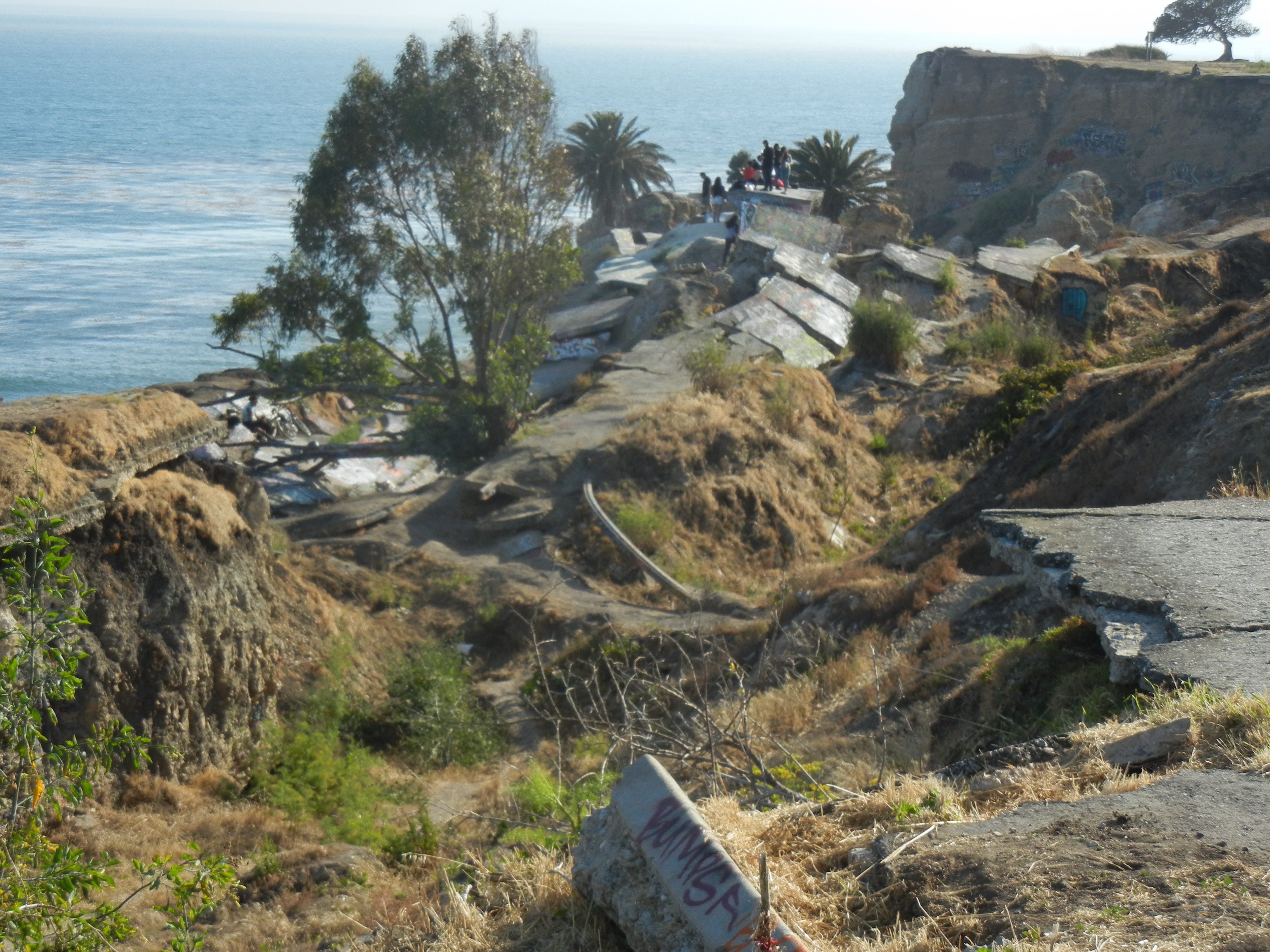
On the coast of Point Fermin in San Pedro lie the ruins of a seaside community. It is known locally as “Sunken City”.
In 1929, there was a landslide caused by geological changes at Point Fermin that caused several homes to slide into the ocean. It started with a crack on January 2, 1929, which went from the sea cliff at Point Fermin Park inland and then out to sea at Paseo del Mar and Pacific Avenue. About a dozen buildings in the five-acre area had gas and water lines broken. 1
The City of Los Angeles was considering purchasing the endangered area for park purposes. As a side note, San Pedro is officially part of the City of Los Angeles. There did not appear to be much concern in August. According to a news report, “Similar earth slips have occurred for years along the Palos Verdes hills, William Mulholland, builder of the Los Angeles aqueduct, said. In some cases the land finally stops sinking while in others it has toppled off into the ocean.” 2
By 1940, most of the homes were relocated; a 1940 alteration permit for relocation of a dwelling at 565 Paseo del Mar to 728 Paseo del Mar states, “THIS IS EMERGENCY AS THIS BUILDING IS SLOWLY MOVEING [sic] TOWARD THE OCEAN.” The slide displaced houses, commercial buildings, streets and part of Point Fermin Park.3
The land continued to slip and the cracks grew larger over the subsequent decades. In the winter of 1969-1970, there were heavy rains that ultimately caused several homes to fall onto the rocky beach below. In 1970 the landslide zone was declared a disaster area by the Small Business Administration.4
Homeowners in the affected area were given property tax relief because of a bill authored by San Pedro Assemblyman Vincent Thomas (as in the bridge.) The landslide area then was designated an emergency area by Governor Ronald Reagan.
It is currently fenced off, and many trespassers have died at the site. While there have been proposals to open the site via a gate, a good view can be had from outside the fence. It is located at the east end of Point Fermin Park (near the lighthouse) and can also be viewed from nearby streets. With all the Palos Verdes land movement in the news lately, you can see that it has been an issue for a long time.
Note: We visited the site and took these photos in 2015. There may have been work done in the area and there have obviously been more land movement after heavy rains in the recent past. You may want to check online for the current status if you plan on visiting.


Landslide May Alter Port Tip, Los Angeles Times, May 18, 1929, p. 17
City May Purchase Point Fermin Zone Menaced by Slide, Press-Telegram, August 23, 1929, p. 12
Historic-Cultural Monument Application for Walker’s Cafe, Los Angeles Department of City Planning, January 20, 2022
U.S. Acts on San Pedro Slide Area, Los Angeles Times, January 21, 1970, p. 2
Interesting, is this related to the current neighborhood sinking in the area?